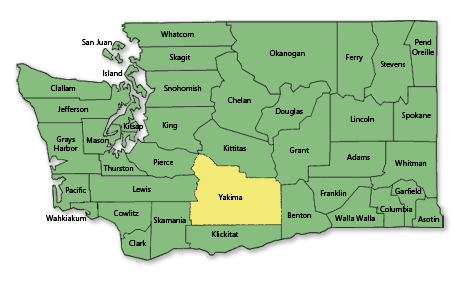
Yakima County Sheriff’s Office
1822 South 1st Street
Yakima, WA 98903
Phone: 509.574.2500
Yakima County is named after the Yakama tribe of Native Americans. In 2017, the estimated population was 250,193. The county seat is Yakima, which is also its largest city. The highest point in the county is Mount Adams, the second tallest peak in Washington, at 12,277 feet (3,742 meters) above sea level.
Yakima County was formed out of Ferguson County on January 21, 1865. Ferguson County, no longer in existence, had been formed out of Walla Walla County on January 23, 1863.
According to the U.S. Census Bureau, the county has a total area of 4,312 square miles, of which, 4,296 square miles is land and 16 square miles is water. The population density is 57 per square mile.
Principal Communities:
- Grandview
- Granger
- Harrah
- Mabton
- Moxee
- Naches
- Selah
- Sunnyside
- Tieton
- Toppenish
- Union Gap
- Wapato
- Yakima (County Seat)
- Zillah

